Monitoring pastures with drone technology
The Monitoring Pastures with Drone Technology project (2021-2023) aimed to assess if affordable and commercially available drone technologies are currently suitable for adoption in Western NSW. Additionally, the project aimed to assist landholders in implementing the technology.
The Western region of NSW has the potential to benefit significantly from the effective implementation of drone technology and there is considerable interest in using drones for various applications. However, those who have invested in the technology have had limited success with using it regularly as a tool to improve their management.
Mapping with drones
To assess if drones are useful for monitoring pastures and making grazing decisions in rangelands, available drone technology was tested in varying conditions across Western NSW over a 2 year period.
Drones and software were used to complete seasonal maps, with the results then compared to on ground monitoring to assess capabilities, practicality and potential uses.
The demonstration was designed to test a method of using drones for monitoring pasture that was practical, affordable and commercially available to landholders.
Results found the drone was capable, reliable and practical to use for collecting pasture data. The main advantages of using the drone were its ability to collect a larger sample area more efficiently, reduce time out in the paddock and potentially improved accuracy due to reducing human error.
The downfall of using this technology is the software. The operations that the software is designed for function well and are user friendly but using it to extract the desired pasture measurements is currently limited. The built in measurement feature allowed landscape organisation to be completed from the mapping which saved time spent in the paddock and was more consistent as a straight line was used on the map rather than a tape measure.
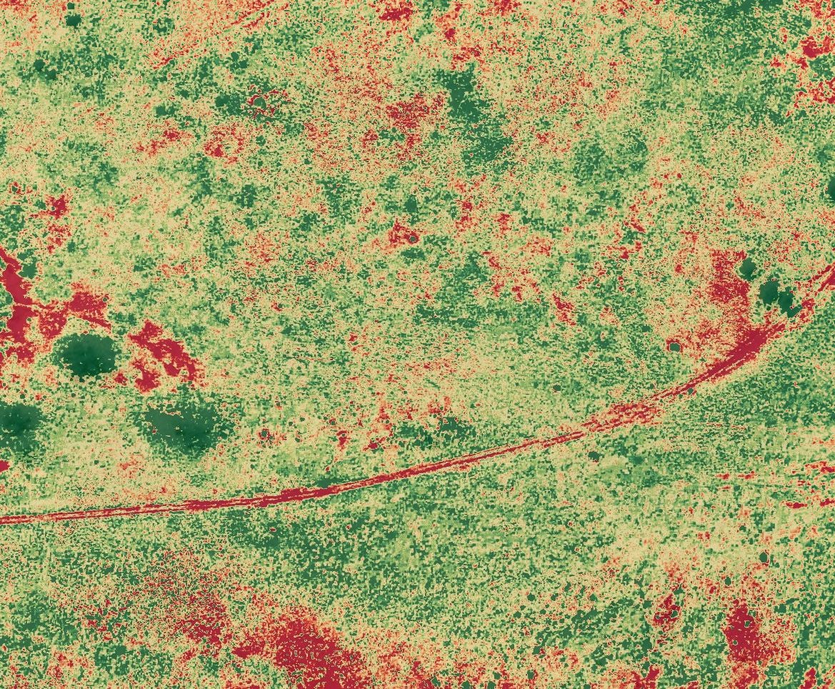
Figure 1. Example of the “plant health” drone map for the 1 ha ground truth area. The map was collected on 19 December 2022 in a spear grass and annual pasture vegetation paddock.
Uses for the drone pasture maps
Although values were able to be extracted from the drone maps, it was not a simple process and is not what the software is designed for. In the future, specifically designed software may become available and will make this process simpler and more suitable for purchase, adoption and implementation as a pasture measurement tool.
Currently drones can provide value for managing pastures by being a visual tool to improve current on ground monitoring techniques and records. Due to minimal testing and the features requiring adaptation to suit the purpose, it is important to validate results with on ground data.
Combining these techniques will improve results in relation to the time spent collecting and analysing information.
A simple solution would be to use a drone to take aerial photos as part of regular monitoring protocols. Aerial photographs allow a larger area to be observed from different angles that can more effectively show pasture changes compared to photos taken at ground level.
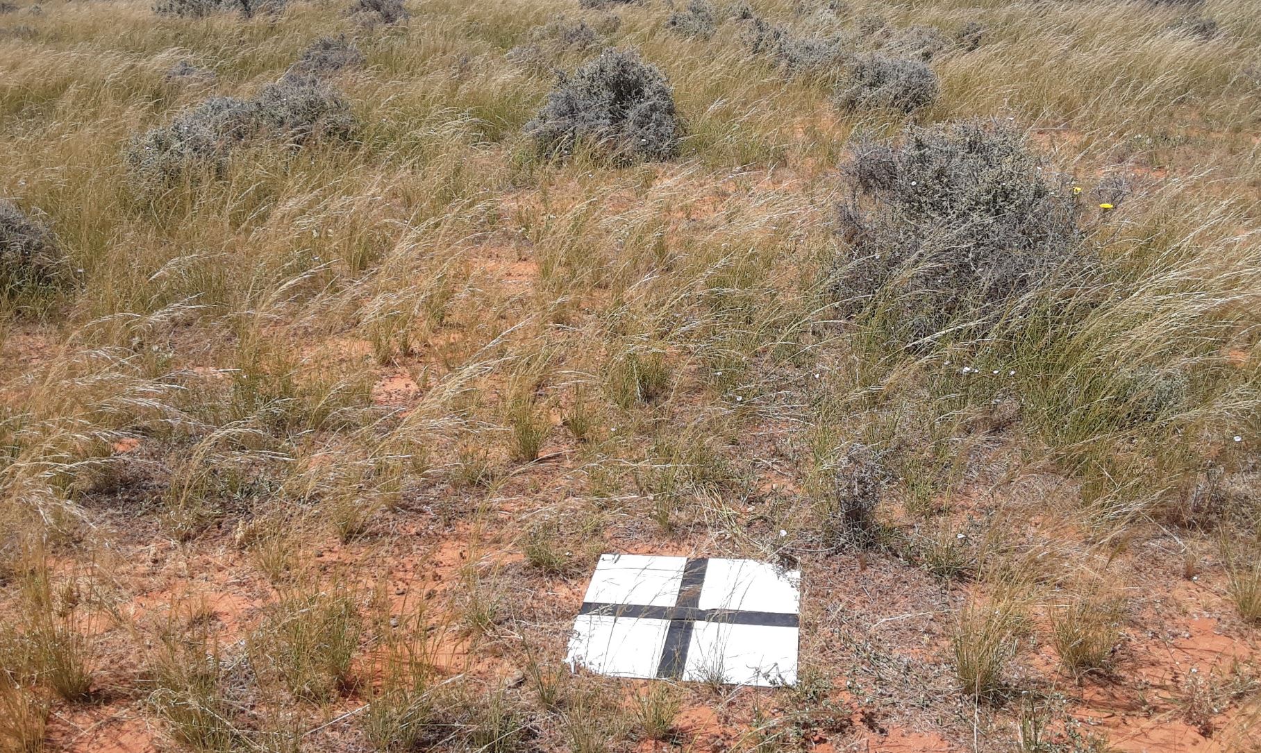
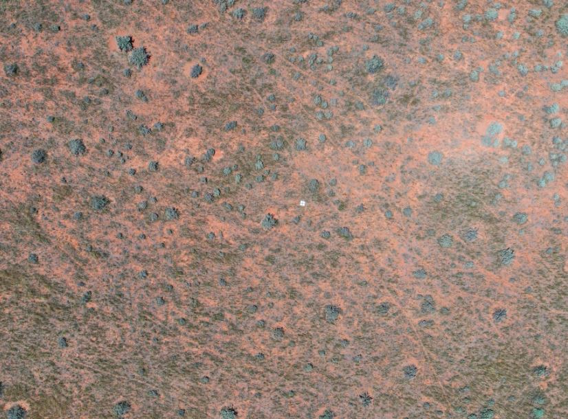
Figure 2. Comparison of on ground photo with same area on the same day from the air.
Other uses and implementation of drones in Western NSW
As part of the project, a series of workshops were held across the Western region to increase participant capacity to effectively use drones and allow them to contribute to discussions focused on the implementation of the technology.
These events identified that drones are of interest to assist with labour shortages, safety concerns, access to difficult terrain, reducing costs, increasing efficiency, monitoring and reducing wear and tear on vehicles. Specific applications of interest included:
- mustering
- pasture monitoring and measurement
- checking infrastructure e.g. water and fences
- monitoring animal health
- weed spraying – blanket and precision
- managing pest animals- spotting, infrared, measuring impact e.g. warrens, digging
- plant health and precision management in orchards
- planning and mapping infrastructure and earthworks
- observing land management changes
- recording GPS locations
- counting and measuring e.g. number of cactus, approximate length of fence.
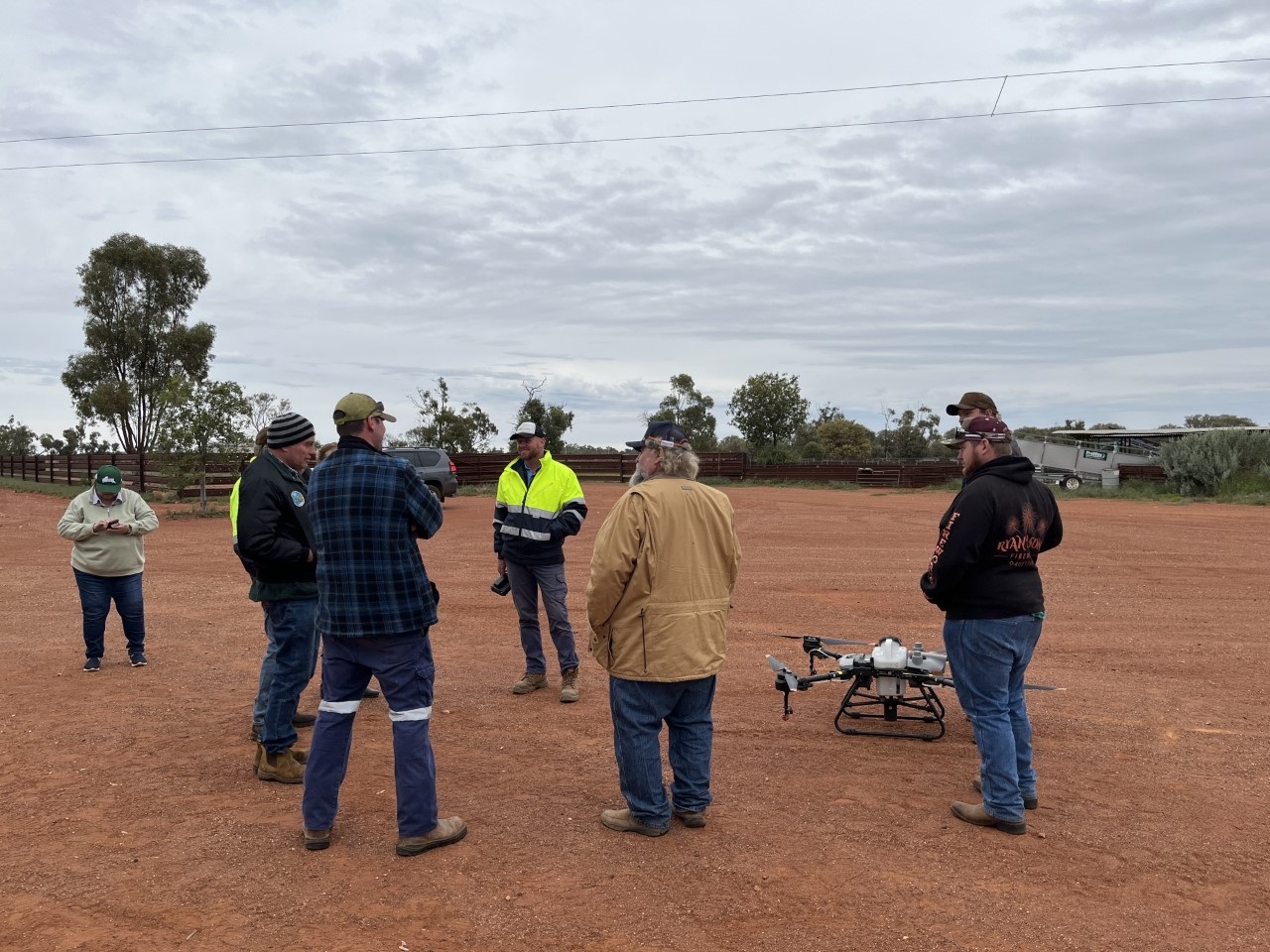
Figure 3. A drone workshop hosted by Dijoe Station, near Cobar.
Other project findings
Experience using the drone
Overall, experiences using the drone and software were positive. Workshop attendees found the technology user friendly and would be more confident using it with practice. A variety of drones and potential software programs were discussed along with education on safety practices, drone legislation and checklists.
Consumer drones
Consumer drones (affordable and available) like the one used in the project have battery life of 25-30 minutes. This limits the time it can save an operator and benefit their business. When purchasing a consumer drone, it is important to check its compatibility with any software that you intend to use as some of the latest models are not compatible yet.
Professional drones
Professional drones are available with longer flight times, as high as 55 minutes for a multi rotor and multiple hours for fixed wings. These drones are also heavier and if they weigh over 25 kg require a REPL even if flying on private land.
Larger drones for spraying and carrying
Bigger drones are available for the purpose of carrying larger quantities for uses such as spraying and fertilising paddocks. However, due to limitations, they are not the best option for large areas that can be accessed by vehicles, but very useful for hard to access areas such as scrub, hills or wet, inaccessible orchards.
Batteries
Consumer drone batteries charge quickly and can be charged on the go using a vehicle’s 12-volt power outlet or power bank. This adds to their practicality and extends their capabilities beyond 27 minutes. The standard drone comes with one battery but “fly more” combinations when purchasing are a common extra which may include additional batteries.
For more information
Download a PDF copy of the Monitoring Pasture with Drones Technology project case study. Contact us by visiting your local office, call on 1300 795 299 or send an email to admin.western@lls.nsw.gov.au