Assessing the condition of riverbank works in the Richmond after the floods
01 Jan 2019
North Coast Local Land Services have been working with Macadamia producers and graziers since 2019 to improve water quality in the Richmond Catchment. This project works with landholders to rehabilitate and enhance creeks and rivers on their properties through weed management, riverbank and in-stream reconstruction, stock management and monitoring.
Unfortunately during the February and March floods some of these sites were damaged by high water levels and high velocity flows. Following the floods, we began carrying out rapid assessments of project sites, assessing damage to plantings, existing vegetation, and bank condition. So far, a total of 18.7km and 36ha has been inspected.
Overall project sites have fared well with sites planted in 2019 and 2020 having better survival rates of plantings due to the size of the vegetation.
Table 1 – Total percentage of the area damaged or affected by floodwaters. The extent of damage can vary from a 10% to 80% plant loss.
TOTAL PROJECT | ||||||||
WATERWAY | PROJECT FOOTPRINT | INSPECTED | FLOOD AFFECTED | PERCENT DAMAGED | ||||
KM | HA | KM | HA | KM | HA | KM | HA | |
MAGUIRES | 11.535 | 25.916 | 5.015 | 11.456 | 1.58 | 3.68 | 32% | 32% |
EMIGRANT | 5.555 | 12.4 | 5.055 | 12.02 | 1.735 | 3.655 | 34% | 30% |
DUCK | 4.043 | 7.04 | 0.893 | 1.4 | 0.165 | 0.38 | 18% | 27% |
HOUGHLAHANS | 2.965 | 4.14 | 0.52 | 0.54 | 0 | 0 | 0% | 0% |
BRANCH | 3.395 | 3.768 | 1.295 | 1.668 | 0.575 | 0.198 | 44% | 12% |
PEARCES | 4.775 | 8.767 | 3.72 | 6.97 | 1.575 | 2.65 | 42% | 38% |
WILLOWBANK | 2.28 | 2.026 | 2.28 | 2.026 | 0.575 | 0.198 | 25% | 10% |
TOTALS | 34.548 | 64.057 | 18.778 | 36.08 | 6.205 | 10.761 | 33% | 30% |
General observations from the post flood assessments include
- Around 33% of river frontage across all inspected sites have been damaged by floods.
- The hardest hit waterways have been Branch Creek and Pearces Creek.
- Project sites with existing older vegetation generally didn’t suffer as much plant loss as sites with reconstruction plantings.
- At sites with a mix of existing vegetation and gaps in vegetation, the areas with gaps suffered more erosion, sediment loss, and plant loss.
- Sites with wider riparian zones had more capacity to handle runoff, especially on steep sites or sites where there is little to no groundcover under orchard canopies. Sites with riparian zones less than 5m wide generally had a lower survival rate pre- and post-flooding events.
- Sites with groundcover under orchards suffered less erosion and sediment during the flood events. It also appears sites with adequate ground cover in their orchards have had a greater survival rate of riparian plantings in the first few years due to less sediment and runoff removing young plantings.
Although the floods have impacted many of the properties in various ways and to varying degrees around the catchment, the MEMS Riparian Rehabilitation projects have helped to reduce erosion and sediment entering the waterways and are providing important biodiversity corridors around the Alstonville Plateau.
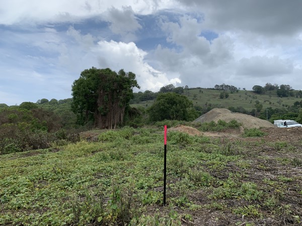
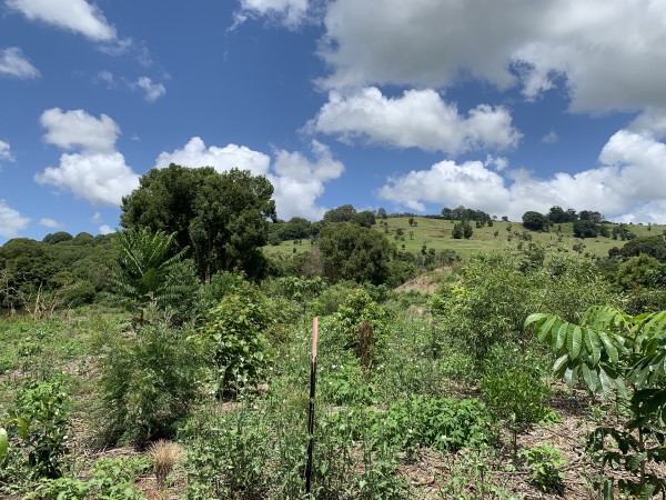
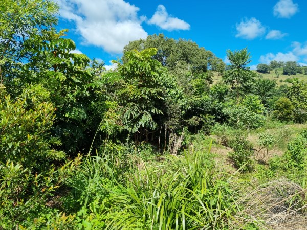
Progress photos of Maguires Creek stage 1: