
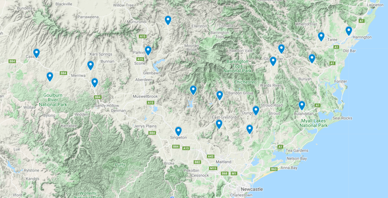
Soil moisture network project
The Hunter Soil Moisture Network is a new initiative to provide landholders with soil moisture information to enable better property management and will increase confidence in decision making across critical times of the year. The network provides real time data to support producers to make decisions around management of climatic variability, natural resource management and seasonal conditions.
With 18 strategically positioned soil probes across the Hunter region, producers can view real time data of soil moisture to a depth of 1m, soil temperature, wind and rainfall. The probes are across a diverse range of soil, pasture and grazing types.
This network provides real time local data to assist:
- pre-emptive decisions concerning feed or fertiliser requirements and timing of livestock sales
- underpin response strategies which increase farmer and ecosystem resilience by optimising farm productivity and natural resource condition
- minimise risk to profitability and land condition by matching stocking rates to feed availability, management of fertiliser application and pasture renovation requirements
Support your grazing decisions at critical times of the season with real time data on climate variability, seasonal conditions and natural resource management:
For further details, contact:
- Sarah Giblin – 0409 785 172
- Nikki Gilder – 0476 796 729
- Peter Beale – 0427 007 468
Our supporters
Hunter Local Land Services would like to thank our contributing organisations.

Managed by a consortium comprised of Monaro Farming Systems, South East Local Land Services, Tablelands Farming Systems and Bookham Ag Bureau through funding from the Australian Government's National Landcare Program.