Regional profile
Our people
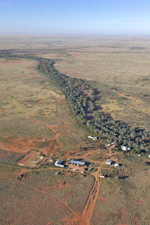
The Western Local Land Service region is the largest in NSW, covering 314,500 km² or 40 per cent of the state. It is larger than Victoria and Tasmania combined. Despite its size, it is the least densely populated region, with a population of approximately 42,873 people (18,500 of whom live in the city of Broken Hill).
Our Aboriginal cultural heritage
Aboriginal people make up approximately 13 per cent of the population. There are many sites of cultural significance including the Brewarrina Fish Traps, Mt Grenfell, Willandra Lakes World Heritage Area, Lake Victoria, Mt Hope and Mutawintji Historic Site. There are 16 current Aboriginal language groups identified. Aboriginal people are passionate about environmental health and many are successful primary producers.
Our climate
Rainfall is low and highly variable – summer dominant in the north and winter dominant in the south. Annual rainfall is highest towards the north-east and lowest to the west, with an average annual rainfall at Brewarrina of 412 mm to 250 mm in Broken Hill. Drought is a major part of the climatic cycle in the Western region.
Our economy
Grazing (sheep, cattle, goats), dryland agriculture (cereals in the southern Mallee), irrigated agriculture (cotton, horticulture and viticulture), mining, tourism and nature conservation are the main land uses within the Western region.
Our geography
The Barwon-Darling River System, part of Australia's longest river, transporting water 2,000 km through a single, meandering channel is located entirely within the region. The Murray River forms one boundary while the Murrumbidgee River forms another. There are a number of smaller and ephemeral rivers and creeks. Major water storages include The Great Artesian Basin, Menindee Lakes and Lake Victoria. It is a predominantly flat area that is interrupted by stony ridges and ranges.